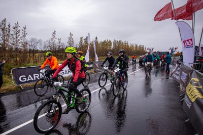
Exciting competition for electronic bikes only. Chip times and loads of fun.
-
Registration Fee
Landsnet MTB 23 KM
Category 1: Electric bikesSaturday 26. August 2023
Start 13:30
- Chip time
- Electric bikes only
- Registration fee until midnight 2. July: 6.900 kr.
- Registration fee until midnight 23. August: 9.900 kr.
- Registration fee 12.900 kr.
Registration fee includes a participation medallion and a post-race meal.
Disclaimer:
*The race committee reserves the right to change the course before the race.
*Tournament management also reserves the right to shorten the course if weather or other conditions on the day of the race call for a shorter race.* Tournament management reserves the right to change the timing if the weather or other conditions on the planned race day call for such a change.
*Decisions about changes are made with the safety and experience of the participants as a guide. - Documents
-
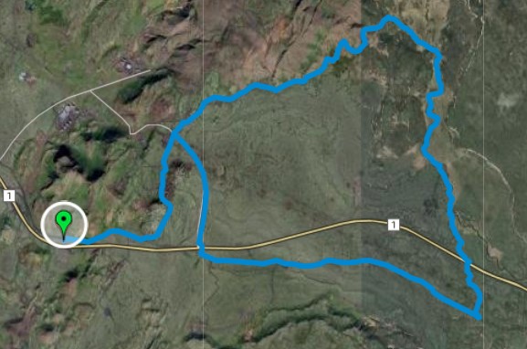
Route description
Category 1 – Electric bikes. Chip time!Landsnet MTB’s starting point is at the Ski Lodge in Hveradalir – Skíðaskálinn Hveradölum. You ride up to Hellisheidi south of the cabin but north of highway no. 1. You cycle along a dirt road around the Hveradalir Mountains and from there to the roots of the Hengil mountain in the north-northeast. From there, you ride on asphalt for a few tens of meters and cycle onto gravel and dirt trails that lead to Skarðsmýri. In that area, the trail rises one of the highest in the route without being very steep or difficult there. Then you come down Hengladalsá and to Fremstadal, but from there there is a free route along the riverbed. Then the path goes down a fairly old path down into the lava again and from there via sheep paths to the underpass under Hellisheiðarvegur/Highway number one. You continue south-southeast to the old highway and there you enter the old highway and from there straight line west along Hellisheiði, but in total that section is about 4.5 km and a fairly easy dirt road.From there you go through an underpass again, but then there are about 4 km left of the track and you go onto asphalt for about 2 km of trail which then connects back to the first 2 km of the track and the bikers come down to the finish line by the Ski Lodge about the same 2 km where the route started on.Please note: This track is under development. In the days before the competition, we will inspect it and measure, we will clear it of boulders and only work on connections between roads to trails and from trails to sheep paths. But this is a challenging track, even though it is not long and does not count a lot of total ascent. On the other hand, it is a lot of fun, and the view from its highest points is completely unique, as you can see almost 360 degrees of the entire southwest country and more.KEY FIGURESTotal distance: About 23 kilometersStarting height: 366 metersHighest point: 473 metersTotal ascent: 262 metersTotal descent: 262 meters


